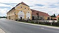
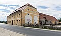
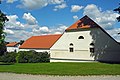
Category:Folwark in Łomnica
Jump to navigation
Jump to search
| Object location | | View all coordinates using: OpenStreetMap |
|---|
Polski: Łomnica, ul. Karpnicka 3b - zespół budynków folwarcznych oraz zespół stodół na terenie parku
Media in category "Folwark in Łomnica"
The following 30 files are in this category, out of 30 total.
-
 2016 Folwark w Łomnicy, druga stodoła w parku.jpg 4,682 × 2,891; 11.15 MB
-
 2016 Folwark w Łomnicy, kuźnia 1.jpg 4,806 × 3,311; 7.78 MB
-
 2016 Folwark w Łomnicy, kuźnia 2.jpg 3,462 × 2,268; 4.48 MB
-
 2016 Folwark w Łomnicy, pierwsza stodoła w parku.jpg 4,282 × 2,976; 10.73 MB
-
 2016 Folwark w Łomnicy, spichlerz 1.jpg 4,570 × 2,578; 6.45 MB
-
 2016 Folwark w Łomnicy, spichlerz 2.jpg 4,734 × 2,822; 7.03 MB
-
 2016 Folwark w Łomnicy, stajnia 1.jpg 4,878 × 2,961; 11.43 MB
-
 2016 Folwark w Łomnicy, stajnia 2.jpg 4,872 × 3,219; 11.18 MB
-
 2016 Folwark w Łomnicy, stajnia 3.jpg 4,790 × 2,937; 10.66 MB
-
 2016 Folwark w Łomnicy.jpg 4,892 × 2,203; 6.94 MB
-
 Budynek mieszkalny (Pałac Łomnica).jpg 6,000 × 4,000; 5.96 MB
-

-

-
-
 Lomnitz-Scheune.jpg 3,216 × 2,144; 1.85 MB
-
 Lomnitz-Schloss-06.jpg 2,966 × 1,982; 1.17 MB
-
 Lomnitz-Schloss-12.jpg 3,202 × 1,801; 1.49 MB
-
 Palac Lomnica (60).jpg 4,000 × 2,248; 3.72 MB
-
 Palac Lomnica (61).jpg 4,000 × 2,248; 3.79 MB
-
 Palac Lomnica (62).jpg 4,000 × 2,248; 3.89 MB
-
 Palac Lomnica (63).jpg 4,000 × 2,248; 3.88 MB
-
-

-

-

-
 Zespół folwarczny11.jpg 4,225 × 2,806; 3.41 MB
-
 Zespół folwarczny12.jpg 4,288 × 2,848; 5.77 MB
-
 Łomnica, dziedziniec dworu (Lomnitz-Gutshof1).jpg 2,045 × 1,150; 523 KB
-
 Łomnica, stajnia w zespole dworskim (Lomnitz-Gutshof2).jpg 1,963 × 1,104; 682 KB
-
 Łomnica. Zespół pałacowy 6.jpg 1,584 × 1,148; 414 KB


.jpg)


.jpg)
.jpg)
.jpg)
.jpg)


.jpg)
.jpg)
